
MAPIR Camera Reflectance Calibration Ground Target Package V2
Sold Out
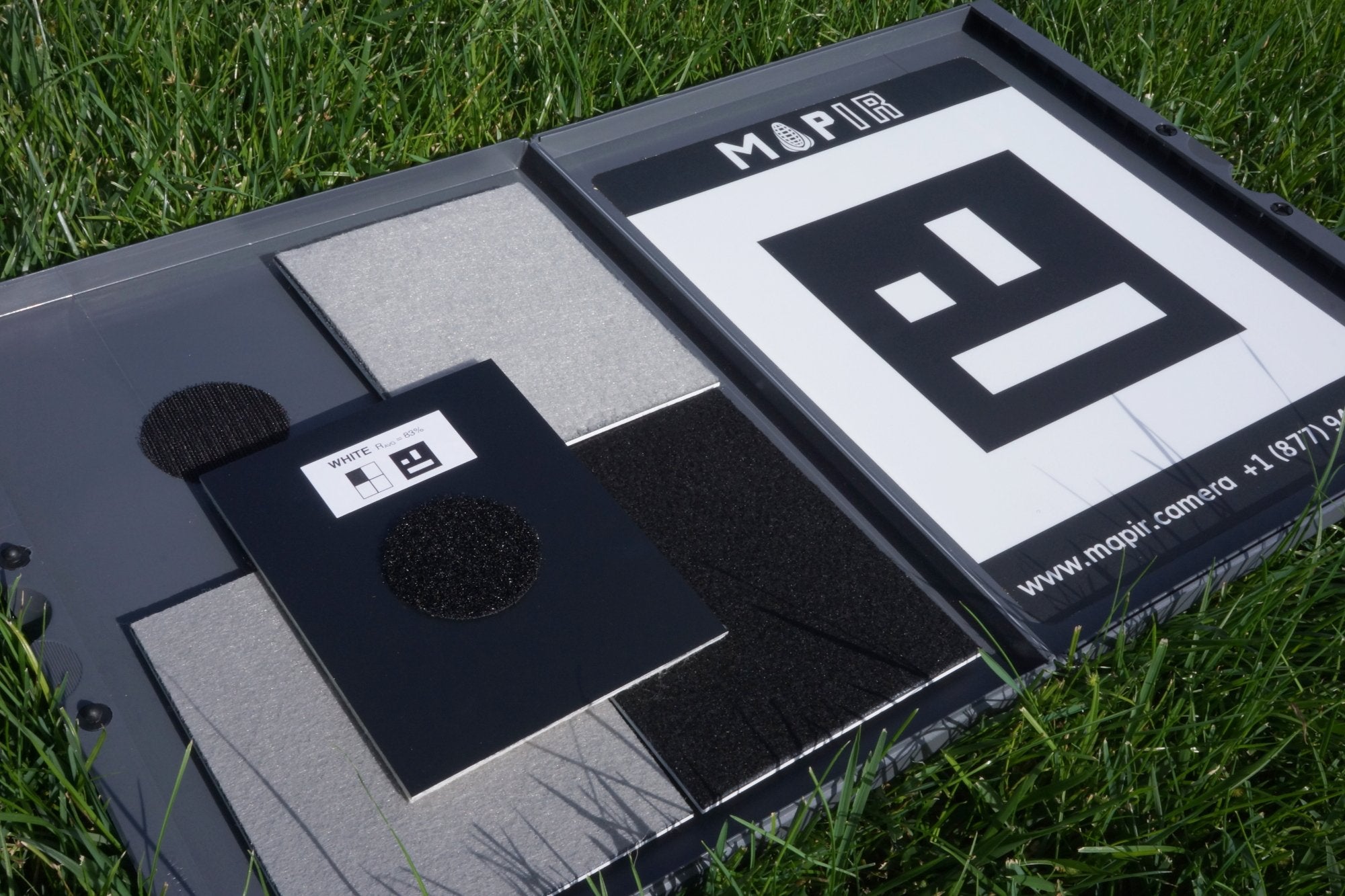
This package contains 4 ground targets that each have known reflectance curves. The target material is composed of a felt-like material mounted to a plastic substrate. It can be captured from any angle with your camera thanks to similar total and diffuse reflection properties.
To use this target, before each flight take a photo using each camera of the entire open package with the targets facing straight up (though no shadows on the entire target area). You would then use these images in our post processing software to calibrate the index image pixel values. This will further improve the normalization of your surveys over time and locations. Full capturing tutorial here.
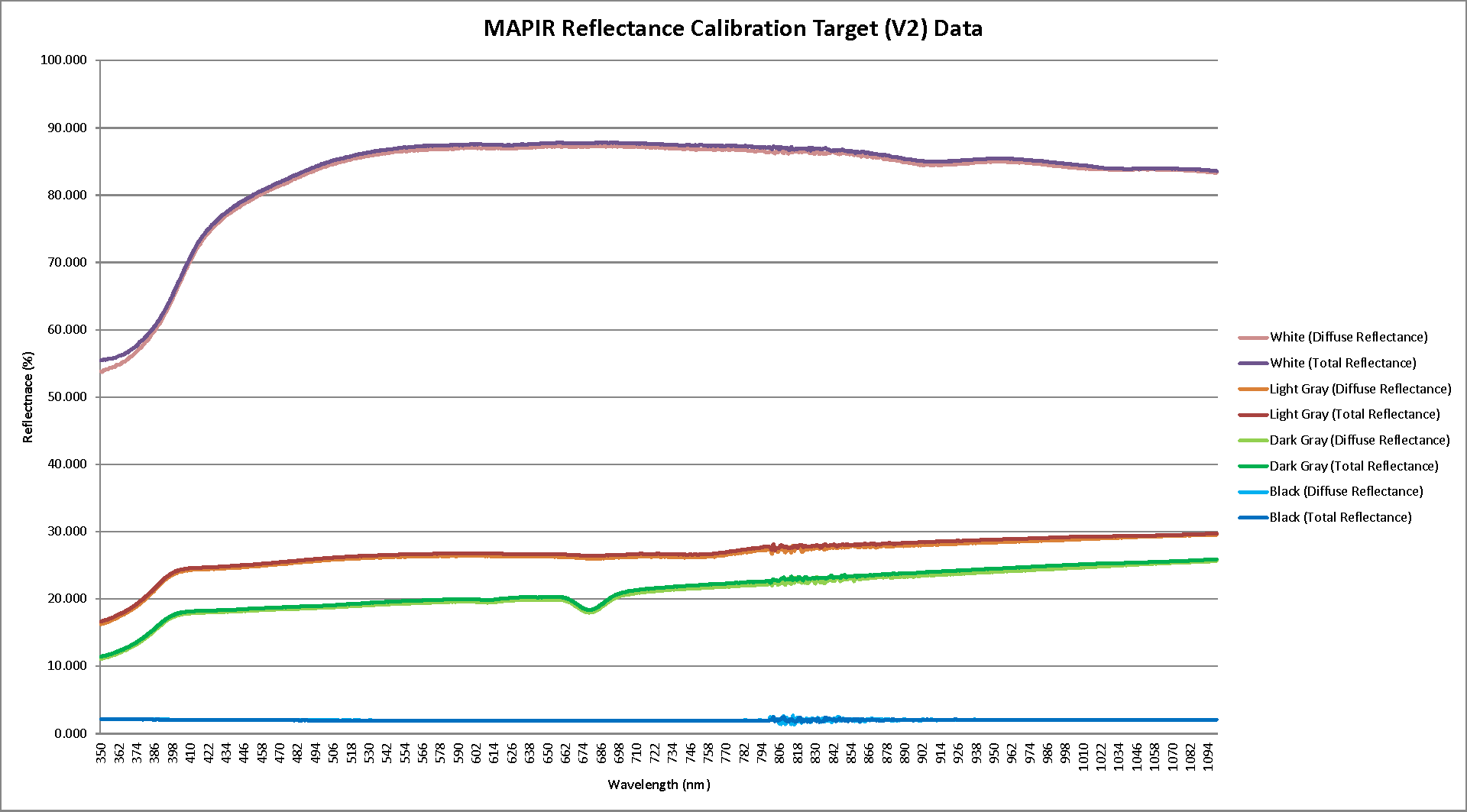
The material used for the targets is similar to felt and thus must be kept debris-free to properly work. We recommend holding your drone over the target or taking off away from it and then hovering overhead in order to reduce the amount of debris that may land on it. A hovering height from 10-15ft is recommended while trying to keep the target in the center of the camera's view. Thanks to the target material's diffuse properties you will no longer need to worry about where the camera is orientated to get good results. The detection pattern (fiducial) is also much lower in resolution making detecting in our post processing software that much easier, even with images having high noise (typically near-infrared wavelengths). Reflective measurements were made using multiple Shimadzu spectrophotometers incorporating an integrating sphere.
Using our MAPIR Camera Control (MCC) software you can select the photo of this target taken before your survey, the fiducial pattern will be auto-detected and the reflectance value of each target will be calculated and applied to each of your images. The resulting individual images will then be calibrated and you can generate your ortho-mosaic in the software of your choosing. You can also calibrate the entire ortho, or groups of orthos. Using the Viewer tab in MCC you can calculate the rastor/index images (for example NDVI) and then apply your color map (lut).

Note: We use this same package to create the default values in the Calibration step of our Fiji plugin. While the base calibration works well for perfectly clear sunny days, in order to fully normalize your surveys we recommend using this ground target package each flight.